
C100Fully automatic sampling/online monitoring surface robot is a new generation of water unmanned ship products that integrate the latest materials technology, underwater power propulsion technology, autonomous navigation and automatic control technology. It has an exciting and flexible bottom to realize a large-scale water body.Automatic sample collection, automatic inspection of mobile water quality, pollution source investigation and tracking and other functions.Widely used in conventional operations such as environmental protection, water conservancy, fishery administration, meteorology, water affairs and emergency response to emergencies.
size | Battery life/weight | Maximum speed | Automatic navigation and obstacle avoidance | Lost contact protection | Remote control distance | Storm resistance level | Business Unit |
100×810×470mm | ≥4h / 20kg | 2.5 No / Yes | support | support | ≥2km | Level 3 wind, level 2 wave | Water quality monitoring and sampling |
C100PThe small acoustic hydrological water flow measurement surface robot adopts a dual M-shaped hull design, and the integrated design of business unit mounting devices, module units and hull structure is more scientific and reasonable.It is mainly used for viewing the flow velocity and flow of lakes, river basins, dams and reservoirs, underwater terrain, cross-sectional measurement, and changes in riverbed terrain.
size | Battery life/weight | Maximum speed | Automatic navigation and obstacle avoidance | Lost contact protection | Remote control distance | Storm resistance level | Business Unit |
1047×555×190mm | High speed 2h, cruise 4h/15kg | 4.5 No / Yes | support | support | ≥2km | Level 3 wind, level 2 wave | Commonly used instruments such as hydrology and environmental protection surveying and mapping |
C135The hydrological flow measurement surface robot uses lakes, rivers, reservoirs, harbors and other waters as objects. It is based on the water robot unmanned remote control ship as the carrier, and integrates advanced systems and measurement instruments such as navigation systems, propulsion systems, wireless communication systems, ADCP and other advanced systems and measurement instruments to achieveWireless communication, autonomous navigation and automatic control system work to complete the automatic collection, processing and analysis of flow, flow rate, water depth and other information.Greatly simplify the operation process and make hydrological surveying and mapping easier.
size | Battery life/weight | Maximum speed | Automatic navigation and obstacle avoidance | Lost contact protection | Remote control distance | Storm resistance level | Business Unit |
1350×600×230mm | High speed 1h, cruise 2h/<20kg | 5.5 No / Yes | none | support | ≥2km | Level 5 wind, level 3 wave | ADCP, GNSS, etc. |
C180Water terrain and landform surveying and mapping unmanned ships are targeted by lakes, rivers, reservoirs, coasts, docks, harbors and other waters. Based on unmanned ships as carriers, they can integrate high-precision acoustic measurement and mapping, water quality sampling and monitoring and other instruments and equipment, through wireless communication, autonomous navigation and automatic control systems to realize routine or emergency water quality sampling, water quality monitoring, hydrological measurement, waterway surveying, concealed pipe detection, fence adsorption and other business work.
size | Battery life/weight | Maximum speed | Automatic navigation and obstacle avoidance | Lost contact protection | Remote control distance | Storm resistance level | Business Unit |
1800×840×480mm | ≥6h/30kg | 3.5 No / Yes | support | support | ≥5km | Level 5 wind, level 3 wave | Monitoring/sampling/flow measurement/mapping, etc. |
C230The fully automatic surface multi-function robot uses an autonomous navigation system to automatically collect floating garbage on the water surface, liberate manpower, bid farewell to the traditional salvage model, bringing a new and efficient and convenient cleaning experience, leading urban water surface cleaning work into the era of smart cities.At the same time, due to the large design space, it can also be equipped with a variety of conventional business units for operation, such as underwater oxygen exposing machines, large and medium-sized side sweeping sonars, multi-point samplers, water quality online analyzers, nuclear radiation analyzers, multi-beam mappers, etc.type of instruments and equipment.
size | Battery life/weight | Maximum speed | Automatic navigation and obstacle avoidance | Lost contact protection | Remote control distance | Storm resistance level | Business Unit |
2300×1400×820mm | High speed 4h, cruise 8h/50kg | 3.5 No / Yes | support | support | ≥5km | Level 5 wind, level 4 wave | Commonly used instruments such as hydrology and environmental protection surveying and mapping |
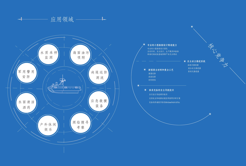
C400Multifunctional water robots are new intelligent water platforms used in the fields of sea area terrain and landform data search, sea area patrol and maritime law enforcement, surface combat military exercises, etc.Equipped with advanced control system, perception system and communication system.The hull adopts a unique dual-M-shaped multi-body design, which can be adapted to high-speed navigation while providing a larger storage space. The mission bin can be equipped with a variety of measurement, surveying, early warning and reconnaissance, search and rescue and even attack equipment.Based on the oil-electric hybrid propulsion system, the maximum speed can reach more than 35 knots, supports short-wave/ultra-wave/satellite communication, and the independent cruise working radius exceeds 300 kilometers.
size | Payload/self-weight | Power system | Boat type | Maximum speed | Economic speed | Storm resistance level | Battery life |
3800×1600×890mm | Viewed 190/210 | Diesel-electric hybrid | Double M Multi-Horse | Chapter 35 | Chapter 15 | Level 7 wind, level 4 wave | ≥70h (when full of oil) |