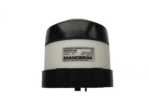
 | The Doppler profile current meter 5400/5400R is a medium-range intelligent sensor with a frequency of 600kHz and a working depth of 300 meters.It collects high-quality current information on mobile and tilted platforms and can be used for commercial and scientific research.A temperature probe is integrated on the sensor, which can be calibrated according to user requirements. | ||||
| The Doppler aerial meter 5400 can be integrated into the Andra Marine Guard platform or the Smart Guardian Cylinder through the AiCaP protocol, or can be directly connected to the computer or third-party system through the RS-232 interface.Therefore, it is particularly suitable for the needs of cross-sectional current measurements in systems with existing data acquisition devices.The 5400R has an RS-422 communication interface, allowing longer cables to communicate in real time. | |||||
| Features | |||||
| 1.Built-in solid state three-axis tilt compensation compass | |||||
| 2.Each pulse is compensated for orientation and tilt | |||||
| 3.Low power consumption | |||||
| 4.Insensitive to pollution | |||||
| 5.Small maintenance | |||||
| 6.Direct output of engineering data | |||||
| 7.Fast sampling speed (up to 10Hz) | |||||
| 8.Output interval 30s~2 hours | |||||
| 9.RS-232/RS-422 output, which can be integrated into most third-party digital generators | |||||
| 10.Flexible configuration of output mode, easy to integrate | |||||
| 11.Each layer thickness is 0.5~5m optional | |||||
| 12. Up to 150 layers can be measured, and the user can define 3 measurement groups | |||||
| Special compensation in mobile applications | |||||
| 1.Each measurement pulse compensates for the orientation and inclination of the instrument, and is particularly suitable for observation of floats and anchor systems. | |||||
| 2.Instrument calculations for tilt compensation for the correct vertical distance for each layer of each energy beam | |||||
| More flexible use | |||||
| 1.In addition to being simple and convenient to use, the instrument has the characteristics of flexible configuration, making it suitable for various scenarios of marine monitoring. | |||||
| 2.Two measurement methods: upward observation or downward observation | |||||
| 3.Narrowband and broadband modes are available to meet different application needs | |||||
| 4.An instrument is used in different usage scenarios; three different profile configurations can be performed simultaneously, each configuration can set the layer thickness and overlap of layers respectively. | |||||
| 5.Surface measurement function, can measure sea currents with a thickness of the surface centimeter level (pressure probe is required) | |||||
| 6.It has surface reference function, the surface is the reference, and the current measurement is maintained at a fixed distance from the surface (pressure probe is required) | |||||
| 7.Read out the engineering data directly | |||||
| 8.The output format can be configured by the user | |||||
| Longer continuous release time | |||||
| 1. Low power consumption | |||||
| 2. Broadband technology has lower power consumption | |||||
| Intelligent data quality control | |||||
| 1. Enhanced data quality control capabilities | |||||
| 2. Bad data is automatically marked, and the status of each measurement layer is automatically recorded. | |||||
| 3. User-selectable automatic pulse algorithm; automatically select the best three-beam pulse combination to remove the impact on data due to the energy blocking of an object due to the passing of an object. | |||||
| application | |||||
| 1. Marine Research | |||||
| 2. Maritime transportation | |||||
| 3. Nearshore oil and gas mining | |||||
| 4. Aquatic fishery | |||||
| 5. Environmental Management | |||||
| 6. Public Facilities Design / Investigation Company | |||||
| 7. Integrate into third-party systems, data buoys, observation systems, etc. | |||||

Note: Indicator parameters will change without notice.